Key takeaways
- Willoughby LEP 2012 commenced 31 January 2013 and governs all DAs
- Chatswood CBD has distinct height, FSR, and street activation requirements
- Heritage villages of Castlecrag, Naremburn, and Northbridge require HIS
- Significant bushland and biodiversity corridors create SEE obligations
- Sydney North Planning Panel — not Eastern City — determines larger DAs
If you are lodging a development application with Willoughby Council, your Statement of Environmental Effects (SEE) must be prepared against the Willoughby Local Environmental Plan 2012 (which commenced 31 January 2013), the Willoughby Development Control Plan, and the mandatory content requirements of Schedule 1, Part 1 of the Environmental Planning and Assessment Regulation 2021.
Get a council-ready Statement of Environmental Effects for your DA in 5 minutes — no town planner, no waiting.
Get your SEE report →- Which planning instruments apply to Willoughby Council DAs
- How Chatswood CBD height, FSR, and activation controls affect your SEE
- What heritage protection means for Castlecrag, Naremburn, and Northbridge
- How bushland and biodiversity corridors create SEE obligations
- When the Sydney North Planning Panel determines applications
What Planning Instruments Govern Willoughby DAs?
The Willoughby LEP 2012 — which formally commenced 31 January 2013 — is the primary planning instrument for the LGA, supplemented by the Willoughby DCP's detailed design provisions for each zone and development type.
The Willoughby Local Environmental Plan 2012 commenced on 31 January 2013. It sets out land use permissibility, height of buildings, floor space ratio, heritage controls, and biodiversity protections across Chatswood, Artarmon, Castlecrag, Middle Cove, Naremburn, Northbridge, and the surrounding suburbs.
The Willoughby Development Control Plan provides detailed design standards for each development type and zone. Your SEE must demonstrate compliance with both instruments and with any applicable State Environmental Planning Policies. The mandatory content floor is set by Schedule 1, Part 1 of the EP&A Regulation 2021, and Council's assessment is framed by s 4.15(1) of the EP&A Act 1979.
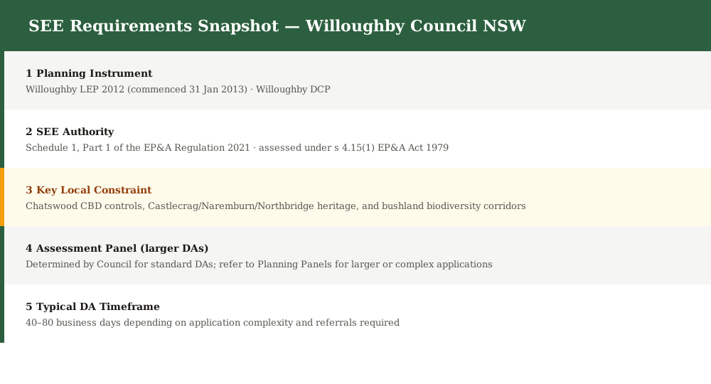
Figure 1: Key planning instruments and SEE content requirements for Willoughby Council DAs.
Chatswood CBD — Height, FSR, and Urban Activation
Chatswood is a major metropolitan centre under the NSW planning hierarchy, with its own LEP height and FSR controls and a strong emphasis on active street frontages and transit-oriented development.
Chatswood is Willoughby's primary commercial and retail hub, and one of the busiest centres on the North Shore. The LEP designates Chatswood as a metropolitan centre and provides dedicated height of buildings and FSR maps for the CBD precinct, with heights varying by precinct.
A SEE for a Chatswood CBD development must address:
- Compliance with the LEP height of buildings map for the specific precinct
- FSR compliance or justification for any variation sought
- Active street frontage requirements and ground-floor use provisions
- Pedestrian connectivity, cycle access, and public transport integration
- Wind and microclimate impacts on the public domain
Heritage — Castlecrag, Naremburn, and Northbridge
Spend 5 minutes, not 3 weeks
instantSEE generates a complete, DA-ready Statement of Environmental Effects online. No town planner. No waiting.
Get your SEE report in 5 minutes →Willoughby contains three of Sydney's most distinctive heritage villages — Castlecrag, designed by Walter Burley Griffin; Naremburn, with its inter-war streetscapes; and Northbridge, with a mix of Federation and inter-war architecture — all requiring heritage impact assessment.
Heritage protection is a central SEE obligation across significant parts of the Willoughby LGA. The LEP 2012 identifies heritage items and heritage conservation areas including:
- Castlecrag — designed by American architect Walter Burley Griffin, with unique round-corner streets and original stone buildings; a heritage conservation area of state significance
- Naremburn — intact inter-war residential streetscapes, including bungalows and Californian-style housing
- Northbridge — Federation and inter-war housing stock on steep, foreshore-adjacent land
Any DA that involves a heritage item or work within one of these HCAs must include a heritage impact statement (HIS) as part of the SEE.
- Identify the heritage item or HCA and its level of significance · Describe proposed works including materials, colours, and finishes · Assess impact on heritage significance, fabric, setting, and views · Propose mitigation measures and sympathetic design treatment · Include archival recording if any heritage fabric is to be removed
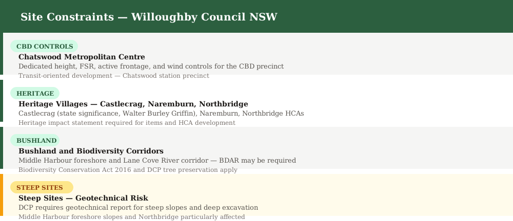
Figure 2: Key site constraints that must be addressed in a Willoughby Council SEE.
Bushland and Biodiversity Corridors
Willoughby contains significant areas of remnant bushland along the Middle Harbour foreshore and the Lane Cove River corridor — biodiversity assessment is a key SEE obligation for properties abutting or near these areas.
The Willoughby LGA includes substantial areas of remnant bushland, including foreshore bushland along Middle Harbour and bushland corridors connecting to the Lane Cove National Park. The LEP identifies these as environmental protection zones, and the Biodiversity Conservation Act 2016 provides an overlay of protection.
Your SEE must address biodiversity impacts where:
- The site abuts or is within 40 metres of a mapped sensitive area
- Vegetation is proposed to be cleared (including under the tree preservation provisions of the DCP)
- The site is within a mapped ecological buffer
Where the Biodiversity Offset Scheme threshold is triggered, a Biodiversity Development Assessment Report (BDAR) must be prepared by an accredited assessor and submitted with the DA.
Middle Harbour Foreshore Controls
Middle Harbour foreshore properties in Castlecrag, Middle Cove, Northbridge, and Seaforth are subject to strict visual impact, setback, and public access controls that must be addressed in any foreshore-adjacent SEE.
The foreshore scenic protection area (FSPA) provisions of the LEP apply to properties fronting Middle Harbour. Controls restrict height, setbacks, and materials to protect the visual quality of the harbour waterway. Any foreshore development must demonstrate compliance with FSPA height and setback controls, show no net loss of public foreshore access, and address visual compatibility with the natural foreshore character.
Common DA Types in Willoughby
Chatswood commercial development, heritage alterations in Castlecrag and Naremburn, bushland-adjacent residential development, and Middle Harbour foreshore projects are the most frequent application types lodged with Willoughby Council.
Willoughby's LGA encompasses high-density commercial development in Chatswood, low-density residential with significant heritage and environmental overlays in Castlecrag and Northbridge, and bushland-adjacent residential properties throughout. Each development type requires specific SEE content.
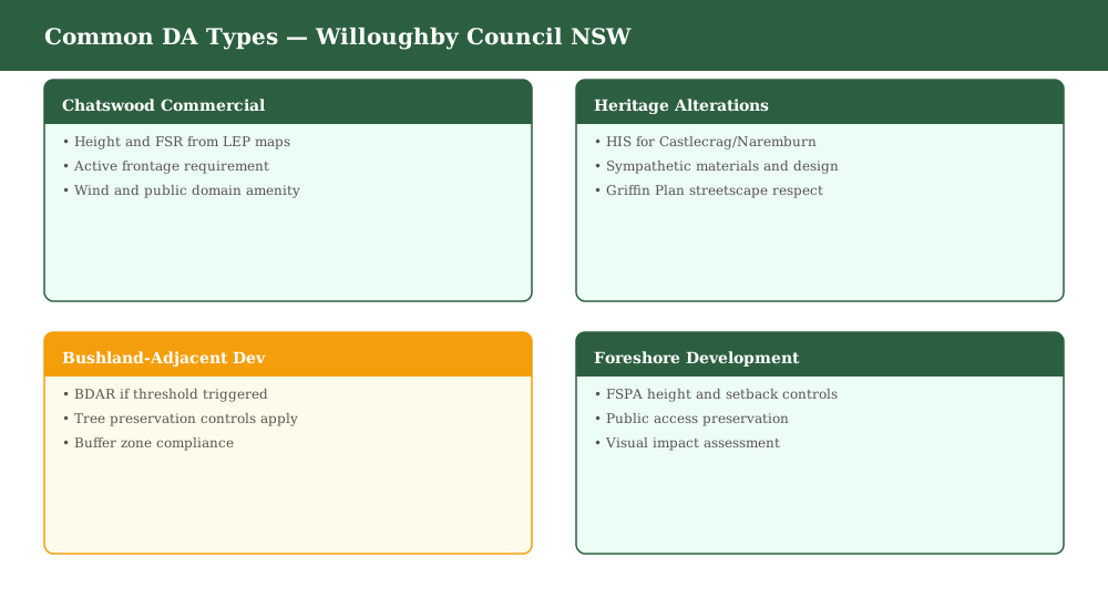
Figure 3: Common development application types lodged with Willoughby Council.
When Does the Sydney North Planning Panel Decide?
Larger and more complex DAs in Willoughby are determined by the Sydney North Planning Panel — not the Sydney Eastern City Planning Panel — when capital investment value or other triggers are met.
The Planning and Environment (Sydney North Planning Panel) Order 2018 gives the Sydney North Planning Panel (SNPP) jurisdiction over Willoughby Council DAs where the capital investment value (CIV) exceeds $30 million, where CIV is $5–30 million and Council is the applicant or landowner, or for certain sensitive, Crown, or designated development.
Note that Willoughby Council falls within the Sydney North Planning Panel jurisdiction — not the Sydney Eastern City Planning Panel that applies to councils to the south.
For SNPP applications, the SEE must meet the higher evidential standard expected by an independent panel and be supported by comprehensive technical reports.
Frequently asked questions
When did Willoughby LEP 2012 come into effect?
Is Castlecrag heritage listed under the Willoughby LEP?
When does a biodiversity assessment apply to a Willoughby DA?
Which planning panel determines Willoughby DAs above the CIV threshold?
Can instantSEE prepare a SEE for a Willoughby DA?
Ready to get your SEE report?
Skip the writing. Get a DA-ready Statement of Environmental Effects in 5 minutes.
Get your SEE report